About This Blog

This is yet another incarnation of my personal blog. Here's where you can read about what I do when I'm not at work: hiking, seeing plays and other shows, eating, traveling, etc.

Popular Posts

Book Review: Hotel on the Corner of Bitter and Sweet

Posted by gck Wednesday, October 31, 2012 1 comments

hotelonthecorner

Hotel on the Corner of Bitter and Sweet by Jamie Ford

Genre: Contemporary Fiction, Historical Fiction, Romance
Rating: ***1/2 (out of 5)
Recommended for: Historical romance fans, book clubs

Back-cover summary:
In the opening pages of Jamie Ford's stunning debut novel, Hotel on the Corner of Bitter and Sweet, Henry Lee comes upon a crowd gathered outside the Panama Hotel, once the gateway to Seattle's Japantown. It has been boarded up for decades, but now the new owner has made an incredible discovery: the belongings of Japanese families, left when they were rounded up and sent to internment camps during World War II. As Henry looks on, the owner opens a Japanese parasol.

This simple act takes old Henry Lee back to the 1940s, at the height of the war, when young Henry's world is a jumble of confusion and excitement, and to his father, who is obsessed with the war in China and having Henry grow up American. While "scholarshipping" at the exclusive Rainier Elementary, where the white kids ignore him, Henry meets Keiko Okabe, a young Japanese American student. Amid the chaos of blackouts, curfews, and FBI raids, Henry and Keiko forge a bond of friendship - and innocent love - that transcends the long-standing prejudices of their Old World ancestors. And after Keiko and her family are swept up in the evacuations to the internment camps, she and Henry are left only with the hope that the war will end, and that their promise to each other will be kept.

Forty years later, Henry Lee is certain that the parasol belonged to Keiko. In the hotel's dark dusty basement he begins looking for signs of the Okabe family's belongings and for a long-lost object whose value he cannot begin to measure. Now a widower, Henry is still trying to find his voice - words that might explain the actions of his nationalistic father; words that might bridge the gap between him and his modern, Chinese American son; words that might help him confront the choices he made many years ago.

My review:
I know I am giving extra points because of personal bias towards the subject matter. It was a pretty good read. I liked the setting the most -- 1940's in Seattle's International District and jazz clubs. It's also nice that the book shines a light on race relations at the time: Chinese vs. Japanese, the treatment of Japanese during the war, general Caucasian attitudes towards Asians, and attempted Asian assimilation into American culture. Reading the book motivated me to do some reading to find out more about Seattle's jazz history and the Japanese internment camps.

There was definitely a lot going on with the characters that was entirely too convenient, and some of the minor characters were pretty bland. The two characters that stood out to me the most were Sheldon and Mrs. Beatty. The author mentions in the interview at the end that they were his favorites, and that definitely comes through. (I didn't realize until the interview that the author was a man!) I also liked the challenges of the main character's relationship with his father. The father's behavior makes up probably the only moral ambiguity in the novel. Other than that, the good guys mostly do good things and the bad guys mostly do bad things.

Given the weight of the subject matter, it would be easy to pick up this book, have certain expectations about its substance, and be greatly disappointed. However, I enjoyed it as a very readable story set in a very interesting time and place.

TR: Alta Mountain

Posted by gck Tuesday, October 23, 2012 2 comments

Distance: ~10 miles
Elevation gain: ~3800 feet
Trailhead directions and more information on WTA.

This trip report is from mid-September, another trip up the Rachel Lake trail and up from there. The goal was to reach the Alta Mountain summit, but I didn’t get exact enough directions because I assumed the trail would be pretty obvious. This is a mistake I seem to keep repeating, but it always ends up okay in the end because I see something different, and I can always go back and see what I missed. It’s the I-90 corridor after all… not too far of a drive.

IMG_7750  IMG_7769
Left: what I’m told is “Chicken of the Woods” fungi
Right: fall colors

So much for an early start – rock blasting completely closed I-90 Eastbound near the pass until 8:30am, so anyone who woke up really early was probably angry. We hit it around 8:45, so the lingering traffic still slowed us down for a few miles. There were already quite a few cars at the trailhead when we arrived, including a loud group of teenaged boys that I dubbed “the Boy Scouts” that I was really afraid we were going to hear the whole way up. But we left before them and never saw them again. On our way back, we heard a loud group that we thought were “the Boy Scouts,” which was confusing because it seemed like they were going to spend the night. But it was actually a group of middle-aged Asian people, hah.

waterfall  IMG_8150
Left: same waterfall, different years/seasons
Right: small falls on Box Canyon Creek

I hiked to Rachel Lake in July of 2010. Last year in October, I did Rachel Lake and continued on to the Rampart lakes. So this trip marks the third year in a row that I’ve done the Rachel Lake trail. It’s a strong love-hate relationship – there’s a lot to love, a lot to hate. One of the things I love is how Box Canyon Creek follows the trail for a ways, giving pretty glimpses of waterfalls here and there. One of the things I hate? Mile 2.5-3.5 of the trail. The first few miles are pretty much flat, and you gain a lot in the next mile. Listen to the book description: “...at about 2.5 miles, the trail starts upward, climbing steeply as it gains more than 1300 feet in the next mile. That cruel pace is made all the more difficult because of the trail's poor condition.” From the lake, a trail climbs upwards, giving nice views down at Rachel Lake the whole way. Though it’s pretty steep as well, the elevation gain goes quicker and more easily than the creek trail up to Rachel Lake. Soon, we were at the top, and we took a right turn to head towards Lila Lakes and Alta Mountain.

IMG_7859  IMG_7958_stitch
Left: fall colors, looking down at Rachel Lake
Right: Lila Lakes, Hibox Mountain

For this hike, I figured that Alta Mountain was a popular enough destination that the trail up would be very obvious. For the most part, it probably is, but there is a crucial junction after the initial split that I didn’t know about. One way climbs the ridge of Alta Mountain, and the other goes towards Lila Lake and tarns. There are so many social trails on this hike that I’m not even sure where we missed this turn, and I’ve only deduced it by reading other people’s trip reports. I don’t think taking this route was necessarily a bad thing, though. We got some nice, closer looks at the beautiful Lila Lakes and a few tarns, and the mountain views were still quite good. Lots of great campsites in this area, all empty, but we met a number of backpackers heading up on our way out.

IMG_8027_stitch

We weren’t the only people who ended up this way by accident. We met a guy heading back who said he’d been trying to reach Alta but couldn’t find a trail up and then ran out of time. The trail lead up to a saddle between two peaks, and we weren’t sure which one was Alta. (I clearly did not learn my lesson with Labyrinth) The trail quickly died in one direction, so we headed for the other peak (which was also the one that we could see people on). I believe this was a legitimate way up the side of Alta Mountain, but it seems more difficult and dangerous than the real way. The trail got spotty pretty quickly, then we ended up climbing up a talus field and found the trail again. I was leading the way, and I got to a point where I realized that it would be really easy to slip, and if I slipped, I would die. It was just a short segment, but it was enough to make me pause. The others were unenthusiastically lagging behind, and it was close enough to the turnaround time that we all agreed to head back. The summit will have to wait for another year. We lucked out with the views anyhow – with all the fires going on in Eastern Washington, people have had hazy views pretty far west, but I guess the winds were blowing the right way for us that day.

IMG_8083_stitch

Hunting season has begun, and that weekend apparently marked the start of high hunt, when deer hunters are allowed up in some of the wilderness areas. I was a bit surprised to see people coming up in camouflage, carrying rifles. Not exactly sure where the deer were hiding up there. Maybe it’s time to get a neon orange hat. The hike down from Rachel Lake was brutal. The steep downhill part wore down my knees and the last 2.5 miles of flat, boring hiking wore down my patience. Overall, this trail is completely worth hiking, though, for some of the best views I’ve seen on the I-90 corridor. However, I think the next time I try to summit Alta, I will take the backdoor route and avoid Rachel Lake for a change.

IMG_8062_stitch

TR: Mirror Lake

Posted by gck Saturday, October 20, 2012 0 comments

Distance: 3 miles to Mirror Lake, ~5 miles to the tarns
Elevation gain: 800 feet to Mirror Lake, ~1200 feet to the tarns
Trailhead directions and more information on WTA.

This was from a trip back in August. Definitely behind on posting these trip reports!

I was pretty time constrained on this hike, so I decided to stick to the I-90 corridor in order to use my time to do more hiking and less driving. Since school hadn’t started for most people yet, I wasn’t terribly excited about dealing with crowds at Talapus and Olallie. Instead, I decided to hike to Tinkham Peak via Mirror Lake. I didn’t pay enough attention to the directions for where the boot path to the peak split from the main trail (big surprise) so I did not end up climbing Tinkham. Instead, I accidentally stumbled upon the trail to my backup plan and spent a lazy hour or so lounging around some beautiful tarns.

IMG_5658  IMG_5672
Left: Cottonwood Lake
Right: Mirror Lake

The “not paying attention to directions” thing started well before I began the hike. The directions seemed pretty simple: Take FR-54 (Kachess Lake Rd) from I-90, turn right after a mile onto FR-5480 and go ~7 miles until it turns into a road that is no longer drivable, then park. Simple, right? Well, a few miles in, 5480 intersects with FR 112 and you have to unintuitively take a slight right to stay on 5480. I went straight. The road seemed kind of rough at first, but it did “continue up a hill above Lost Lake” as the book described, so I kept driving… If your normal life is too tame for you and you’ve been seeking thrills through skydiving or Craigslist dates, let me save you some money and suggest an alternative: take an average sedan up FR 112 until your tires start spinning and you can’t drive up any further. Then you’ll realize that you’re on a steep and narrow, cliff-adjacent, barely-one-lane road with no cellphone reception. True story. After pulling out my GPS, swearing about being on the wrong road, imagining my car plunging 500 feet down into Lost Lake, and freaking out a little, I managed to coax my car past the tricky spot to a turnaround point. Going down was just as nerve wracking. I think my next car is going to be a Jeep.

IMG_5723_stitch
View of Silver Peak and other mountains

Mirror Lake is a fantastic hike/backpacking trip for families. It’s only 3 miles round trip with 800 feet of elevation gain (2 miles if you have a high clearance vehicle and can drive up to the true trailhead… but only two giant trucks managed to make it). I think hiking the forest road up to the trailhead might have been the most difficult part of the hike. Then it’s only half a mile before you get your first treat: the average-looking Cottonwood Lake. There were two fishermen with rafts when I got there but no one else around. It remained quiet as I walked up the remaining half mile to Mirror Lake. It’s not the most scenic hike I’ve done, but there were some flowers on the trail that kept it from being too boring.

IMG_5822_stitch
Glittering turquoise tarn (lunch spot)

There were people at Mirror Lake, but at this time of day, they were dispersed enough around the lake that it still seemed very quiet. There are a lot of nice-looking campsites scattered around the lake. Since this lake is on the PCT, at this time of year there are a lot of thru-hikers passing through the area and would probably have some great stories to tell. It was too windy for Mirror Lake to live up to its name, but it’s quite scenic with dark turquoise water and Tinkham Peak in the background. Definitely as pretty as Melakwa Lake or Mason Lake, which are far more difficult to reach. On my way back, around 2pm, there were definitely more people on the trail and I didn’t bother swinging by the lake. Lots of people hauling their toddlers up. Not sure there were enough sites to accommodate them all.

IMG_5711  IMG_5842  IMG_5861
Pretty colored tarns

After walking around half of Mirror Lake, I kept moving, thinking I was going towards Tinkham Peak, but I ended up on a trail to a magical place with little teal-colored tarns. One or two parties were there, but no one was at my tarn, so I got to eat lunch and relax in the sun by myself. There were a bunch of fish jumping in that tarn. A nice way to finish off an easy lake day!

Movie Reviews: Trishna, Payback, The Color Wheel

Posted by gck Friday, October 19, 2012 0 comments

Still super behind on my blog posts! I’ve got book and movie reviews to write and hike reports to post. But now that our Seattle weather has turned sour, hopefully I’ll have more time to update. These are movies I saw during the summer. Funny enough, all of the films in this list were free. Trishna was a free advance screening, I used volunteer vouchers for the two at SIFF, and the Color Wheel was a free ticket that came with my NWFF membership.

trishna
Trishna
UK, 2011
Genre: Drama, Romance
Watched: in theater, Pacific Place
Rating: ***1/2 (out of 5)

When I originally saw the film list for SIFF 2012, Trishna was one of the films I was most excited to see. An interpretation of Tess of the d’Urbervilles set in Rajasthan – sounded beautifully tragic, right up my alley. I was out of town the first weekend of the festival, and all of the screenings fell during that time. I knew it would come back to the theaters, so I waited patiently and read the reviews coming in. I was happy to get a free pass to an advance screening over the summer, but I had also lowered my expectations for the film, which was a good thing. I haven’t read Tess of the d’Urbervilles so I didn’t need it to be faithful to the book, but I did not like how the character of Jay was interpreted, something of a cross between Angel Clare and Alec. He is portrayed as a somewhat sympathetic character in the beginning but quickly morphs into someone who makes Trishna’s life miserable. Her metamorphosis from being naïve and happy to being bitter and sad happens just as quickly, so when the end events occur, it is jarring and incomprehensible. The reactions in the audience that day indicated that I wasn’t the only person who was surprised. Still, this is a visually gorgeous movie. Rich colors, beautiful scenery, all living up to my expectations. I just wanted a bit more out of the story.

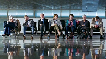
bestexoticmarigoldhotel
The Best Exotic Marigold Hotel
UK, 2012
Genre: Drama, Comedy
Watched: in theater, SIFF Uptown
Rating: ***1/2 (out of 5)

After seeing one of the Slumdog Millionaire stars quietly suffering in a luxurious Indian hotel, I went mainstream and watched the other Slumdog Millionaire star luring British retirees to stay at The Best Exotic Marigold Hotel, where everything was great! Or was planned to become great… soon. This is a pleasant, feel-good movie with a stellar cast and lovely shots to introduce the viewer to India. No huge surprises or revelations, but it was an enjoyable film to watch.

payback
Payback
Canada, 2012
Genre: Documentary
Watched: in theater, SIFF Film Center
Rating: **** (out of 5)

My friend Alexis was interested in this film, and I was glad she mentioned it to me because I would have ignored it completely. Payback is a documentary version of Margaret Atwood’s book by the same name, and it interweaves a handful of stories with Atwood’s readings, all focused around the idea of payback. The biggest criticism of this film seems to be that it isn’t focused towards one solid conclusion, but I found that this actually left a lot to talk about after the film, which is what films like this should seek to do. There was a story about a man who had the right to kill another man if he or his family ever set foot off of his property, bringing up topics of revenge and forgiveness. There was a story about the migrant workers who grow and harvest the tomatoes that America is dependent on, bringing up the idea that we owe a debt to these workers that is far more than what they are paid. And there was a story about the oil spills in the Gulf of Mexico, powerful images that I had all but forgotten as the years passed, about the debt that we are racking up against nature. There’s one about prisoners and the idea of the debt against society. Definitely recommended. Watch it with friends and have a chat afterwards.

colorwheel
The Color Wheel
USA, 2011
Genre: Comedy, Drama
Watched: in theater, Northwest Film Forum
Rating: **** (out of 5)

Another Alexis recommendation, this time a strong one – this was one of her two favorite films of 2011, back for a reprise at the Northwest Film Forum. I agreed that this film was a hidden gem and exactly what a successful independent film should be. It was quirky and not at all mainstream in the sense that when I laughed, it was at things that were surprising and nonformulaic. The two main characters are siblings with a can’t-believe-it’s-actually-functional relationship, and the female deals with the aftermath of a dysfunctional romantic relationship with an older man. When the siblings attend a party, it turns into a social misfits vs. “mean people who are still mean” encounter, sort of like a high school reunion nightmare. All of these relationships are easy to relate to in some way. Ultimately, it’s hard to sum up why movies like this are great, so this is as good as it’s going to get.

TR: Minotaur Lake and Labyrinth Mountain

Posted by gck Thursday, September 27, 2012 0 comments

Distance: 3.5 miles to Minotaur, ~6.5 miles to Labyrinth
Elevation gain: 1850 feet to Minotaur, ~2700 feet to Labyrinth
Trailhead directions and more information on WTA.

In mid-August, I decided to do a lake/summit to take advantage of the views that the sunny weather would yield. I love Highway 2 hikes, but they have deceptively long drives to the trailhead. This one was a few miles past Stevens Pass, plus about 8 slow miles on forest roads of the “cliffy variety” – pretty disconcerting when you realize you’re on a one lane road with only a few feet between you and a cliff. The trailhead is at the end of a road off of Smithbrook Road (FR 6700) and surprisingly requires no special pass for parking.

7779292616_e21b1e3a71_z  pic1
Left: the trail after it left the Forest of Pain
Right: Minotaur Lake

I suggested the Gold Creek trail for people who hate elevation gain but don’t mind distance. If there are people who feel the exact opposite, Minotaur Lake is the trail for you. It’s only 1.75 miles to the lake, but it starts out by gaining about 1200 feet in less than a mile. Super fun, let me tell you. Not only is the steepness terrible, this section is also extremely boring. The forest does at least keep you shaded, but it’s sparse and unscenic. As I made my way up, I was thinking to myself that there was absolutely no way I would recommend this hike to anyone.

529971_10101705436458598_1873136096_n  7779293508_666bef1861_z
Left: looking down at Theseus Lake
Right: creeks, alpine meadow

I knew from reading trip reports and trail descriptions that after the grueling mile, there was a short reprieve as the trail left the forest, but then it would climb again. Here, it started looking more like a hike. There were some wildflowers, a small tarn, mountain views looking back, and fields of what look a lot like huckleberry plants. Could be a nice hike in berry season. I guess I’ve gotten pretty jaded because when the trail started going up again, I expected it to do so for way longer than it did, and I was completely surprised when I hit the lake. Suddenly, the hike felt a lot better – I hit the lake way earlier in the day than what I’m used to. Took some photos here and kept going, wanting to make the summit before lunchtime.

7779297524_687aea6216_z  304509_10101705438329848_2101511404_a
Left: summit register with Theseus and Minotaur in the background
Right: USGS marker

Theseus Lake is right next to Minotaur but 500 feet down. There are numerous viewpoints down to the lake as you head up the east side of Minotaur, and the trail down to Theseus was also visible. It’s a steep fisherman’s trail like the ones I end up on when I go backpacking, and I made a mental note of this as a potential future destination. I saw a group of people planning to camp at Minotaur on my way out, but only one group went down to Theseus. Speaking of people, I’d expected a trail like this to be quite popular, but I think I saw about as many people as I do on trails in October! Saw no one on the way up to the lake, then two at a Theseus viewpoint and two more at the Labyrinth saddle. After that, saw no one until I went back down – the ridge walk and summit were all mine to enjoy in private.


Video of a plane flying through and the view from the summit

Once you get around Minotaur, there are lots of trails that lead up to the top of Labyrinth. When trying to do something like this, it’s good to 1) be able to follow a trail and 2) know where you were going. However, I proved that even if you meet none of the criteria, it’s still okay for this hike. The area is so open that it’s really not possible to get completely lost. If I’d realized which one was the real summit, I would have taken a quicker way up. Instead, I followed a trail towards the saddle, aiming for the false summit (it does look taller!). So I did a little more scrambling than I needed to, but it really wasn’t much. Most of this stuff is walkable. I got tired with all the ups and downs on the ridge that I almost decided to stop, but I found some energy after sitting for a few minutes and then made it to the true summit, signing my first ever summit register! I sat and stared at Glacier Peak as I ate my lunch. A few fighter jets were going through the valley so I got to see a nice airplane show, too. As with any summit, it’s 360 degree views. Mountains all around, Minotaur and Theseus below, and perhaps the Skykomish River in the distance.

7779297156_d861a4ece9_c
View of Glacier Peak

I expected to be a lot quicker going back down because I took a more direct path from the summit (instead of heading back to the saddle) and because down is just easier. I ended up losing the trail and having to backtrack a number of times so I hit the lake later than I would have liked. Then the steepness of the Forest of Pain took some time, too. It was so steep in places that my feet would slip from underneath me and only my poles kept me from planting my butt onto the ground. As I was heading down, I saw a dog coming up. Moments later, a guy followed… with an artificial leg. And an overnight backpack. Kudos to him. I no longer felt like whining after seeing that.

376667_10101705437376758_1455294598_n
Looking towards the summit from the saddle

I still don’t know if I’d recommend Minotaur Lake on its own as a day hike. It’s too long of a drive for a short and brutal hike. But combined with Labyrinth, it’s completely worth it for probably one of the easiest summits in the region with two lakes thrown in as a bonus. I’m certain I will repeat this hike in the fall one of these years.

Movie Reviews: Moonrise Kingdom, The Intouchables

Posted by gck Wednesday, September 26, 2012 1 comments

Started this blog post a few months back, but I never got around to finishing it. After SIFF 2012 ended, I maintained my excitement about the movies for awhile! I caught a Studio Ghibli film as part of the volunteer appreciation party (the other option was Eden, which I didn’t want to rewatch so soon), then did a SIFF-style back to back watching of two festival favorites at Pacific Place. Since then, I’ve been seeing movies in spurts here and there, particularly things that I missed at the festival and have gotten wider releases since then.

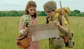
moonrisekingdom
Moonrise Kingdom
USA, 2012
Genre: Comedy, Romance, Coming-of-Age
Watched: in theater, Pacific Place
Rating: ****1/2 (out of 5)

Wes Anderson! Wes Anderson! Everybody loves Wes Anderson! Well, everyone except me, I guess. I didn’t even recognize the name, and when I looked at the other movies he’d made, I hadn’t seen most of them and I disliked the ones I had seen. However, I really enjoyed Moonrise Kingdom. It was so charming, with great child actors and lovely 60’s setting and coloring. So much to enjoy here… Edward Norton as a scout master, Tilda Swinton as “Social Services,” the whole New England setting, etc. It’s not a film that blows you away, but you’ll quietly fall in love.

theintouchables
The Intouchables
France, 2011
Genre: Drama, Comedy
Watched: in theater, Pacific Place
Rating: **** (out of 5)

Second highest grossing movie of all time in France. Highly praised at SIFF. The description didn’t sound all that appealing, but the trailer makes it clear how funny and heartwarming this film is. I didn’t realize until the end that it was based on a true story, though it did seem like there were probably a lot of artistic liberties taken with it. Overall, I enjoyed it and laughed, but I didn’t get the strong emotional connection that I’d need to give this a higher rating.

beastsofthesouthernwild

Beasts of the Southern Wild
USA, 2012
Genre: Drama, Coming-of-Age
Watched: in theater, SIFF Uptown
Rating: *** (out of 5)

Two huge sold out screenings at SIFF, highly hyped all over the festival circuit. It sounded like my thing – coming-of-age, set in Louisiana, fantasy elements. But from the trailer, I couldn’t understand why everyone was calling it the best movie of the year. The representative image everyone else uses is Hushpuppy running with sparklers, but I feel like that presents an inaccurate summary of the film. The image I’m using speaks to me more. Strong, determined characters living in a dirty and different world. There were things I liked about it. Quvenzhané Wallis as Hushpuppy is a great child actress. My strong reaction to the conditions the residents of the Bathtub live in reminds me that I do live a sheltered life. But overall, the movie isn’t enjoyable. Every adult in the community is an alcoholic, and Hushpuppy’s father is a violent one. It’s tough to see the kids in such deplorable conditions, even though they seem to enjoy their lives. The fantastical aurochs make for interesting images, but I didn’t relate to them as symbols. Finally, the shaky camera is pretty extreme. It gave me slight motion sickness, and my friend who is more prone to motion sickness felt like throwing up.

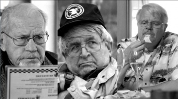
oldgoats

Old Goats
USA, 2010
Genre: Comedy
Watched: in theater, SIFF Uptown
Rating: **** (out of 5)

Each film festival, there are always a few sleeper films that don’t have a lot of reviews going into the festival, and by the time I hear the hype, the screenings are already over or I can’t fit them into my schedule. Then they disappear into obscurity because they were such small productions that they don’t get distribution. And it makes me sad. Old Goats was one of these from SIFF 2011. I was even more disappointed because they screened it for Best Of, but I wasn’t in town that weekend. A tiny, tiny production written and directed by Taylor Guterson (the son of writer David Guterson) with a budget of $5000 (!!!), this film didn’t even have a Netflix entry, much less a release date, so I was resigned to the idea that I would never get to see it. Imagine my excitement when it showed up on the SIFF Cinema fall program! Well, I finally got to see it, and I’m glad I did. Funny characters with strong personalities showing that retirement doesn’t mean that life heads downhill.

TR: Bean Peak via Bean Creek Basin

Posted by gck Tuesday, September 25, 2012 1 comments

Distance: 5 miles to the basin, ~7 miles to Bean Peak
Elevation gain: 2000 feet to the basin, ~3100 feet to Bean Peak
Trailhead directions and more information on WTA.

It has been a hot and dry summer for the Pacific Northwest, and the state of Washington is now paying for all of that sunlight by way of out-of-control wildfires. Back in August, when the good weather spell first began, we were thrilled with the sunny, cloudless weekends. That’s when I got it in my head to try this hike. According to my overambitious original plan for this trip, the report should have been titled “Bean & Earl Peaks.” Obviously, it did not go as planned. Lesson #1: Scrambling in the Teanaway is hard. Lesson #2: August is not the right month to be in the Teanaway. Not long after we did this hike, the nearby city of Cle Elum pretty much burst into flame. That’s about how I felt while doing this hike.

IMG_5111  IMG_5211
Left: hiking in Bean Creek Basin
Right: gold and orange paintbrush

We followed the Bean Creek Basin trail for the first part of our hike. It’s a short trail, 5 miles round trip, but it’s no joke, gaining 2000 feet in this short distance. Fortunately, a lot of the climb during this portion of the trail is in the shade. Once we got out of the forested area, we started seeing the climbable peaks in the area: Judy, Earl, Bean, and more. Normally when there’s a swarm of stuff flying around near water, it’s a big group of bloodthirsty mosquitoes. But we got a nice treat at a creek crossing: dozens of small purple butterflies all fluttering around the same area. So pretty!

IMG_5122  IMG_5088 
Left: flowers of some sort
Right: some of the purple butterflies pretending to be flowers

We bumped into some WTA volunteers heading out from a week long work party and also found their campsite in the basin with lots of supplies. I read afterwards that they’ve been doing a lot of work to the Bean Creek Basin trail to route it in a way that is less damaging to the flower-filled meadows. Good job WTA! The basin was pretty with all the flowers, lots of paintbrush, lupine, monk’s hood, and more. We could see our destination and the trail leading up to it. The trail started as a pleasant, flat walk through the meadow and then suddenly turned into an incredibly steep climber’s trail. Then there was no trail, just a few miserable software engineers scrambling up a steep field of loose scree with some plants mixed in. At this point, the cloudless Eastern Washington heat had taken its toll on me and I was feeling nauseous. Managed to make it up to the saddle without vomiting by telling myself that if I threw up, there was no way we’d have enough water to replenish the lost fluids, and then I would just have to die up there. Fortunately, the mountain views were really nice from the saddle, and that cheered us up considerably.


Video of the butterflies

From there, we walked over towards the summit, bumping into a pair of older hikers who immediately put us to shame by pointing really far away and telling us that they had just come from there. Apparently on the way to Bean Peak, they’d climbed to the top of Volcanic Neck (the dark spot in the middle of the last picture in this post) and it was an experience they would prefer not to repeat again. After they left, we got closer to the summit area and things started to look pretty interesting. We managed, but it’s definitely the most technical scrambling I’ve done. Bob was regretting leaving his helmet in the car, and he still thinks that there’s an easier way up that we didn’t find. We’d both read a trip report of another party that had done this hike recently with chihuahuas, and Bob really wanted to know how the dogs made it up. (Went back and reread the TR afterwards: the dogs and one owner stayed a hundred feet or so below the summit)

  IMG_5233  IMG_5172
Left: Bean Peak
Right: stylin’ summit cairn

Views from the top were pretty fantastic. Looking back towards where we came, we could see Rainier and Adams. In the other direction, it was a panoramic view of Stuart, the Enchantments, etc. It would have been perfect if we could have had those purple butterflies from below flying around us at the summit. Instead, we got biting flies and flying fire ants (termites?). I will say, the view of the peaks is definitely more spectacular than what I’ve seen from the I-90 corridor. However, I think there are probably easier hikes in the Teanaway that might yield similar views.


View from the summit

We made the decision to go down rather than go for Earl, which ended up being the right decision. The ridge walk would have involved some ups and downs and there was more elevation gain to get back to Earl. We had figured it would take us less time going down than it did coming up, but that was definitely not the case for the section from Bean Peak down to the basin. The steepness and all that loose scree was a real pain going down. Once we were down at the basin, it felt like we were almost back to the car. Somehow the difficulty in the second half of the hike had caused my mind to block out the first. We still had 2000 feet to descend. Made it back well before dark, though.

We enjoyed pretty flowers and expansive views and worked really, really hard. My legs weren’t nearly as sore as I expected them to be based on how I felt on the hike, so in retrospect, I think heat and dehydration may have contributed greatly to the difficulty. Maybe I’ll revisit this area sometime when it’s cooler and tag the Earl summit!

IMG_5166_stitch

Labels

Followers