Having lived most of my life in Louisiana (highest elevation: Driskill "Mountain" - 535 ft, haha..) and Indiana (highest elevation: Hoosier Hill - 1257 ft), I found hikes to be rather daunting when I moved to Washington (highest elevation: Mt. Rainier - 14411 ft). After a very pathetic intern experience trying to hike up to Panorama Point at Mt. Rainier (1700 ft gain... if I'd made it all the way!) and an embarrassingly difficult hike up to Wallace Falls (1200 ft), I swore off difficult hiking for quite a few years, adamantly refusing to join friends and co-workers on hikes to Mount Si, Tiger Mountain, and Lake Serene.
But in more recent years, I've been making an attempt to incorporate more physical activity into my life, through torture classes at the gym, skiing, biking, and hot yoga. This things got me in reasonable enough shape so that after a family trip to Glacier National Park, where we did some long hikes with moderate elevation gain, I decided I was finally ready to see some alpine lakes. My co-worker Nitasha and her husband Praveen were totally onboard with the idea, and we've done a good percentage of the hikes since then as a group.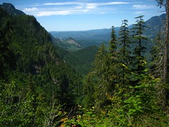
Hike 1: Lake Serene - 7.2 miles, 2000 ft gain
Trailhead directions and other information on WTA.
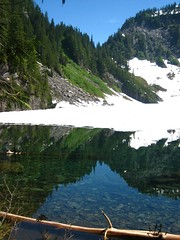
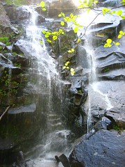
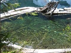
Oh, what a way to start the hiking adventures! This year, the snow in the mountains melted really late, so we had to wait until the end of July for the trails to be reasonable without snow gear. This was a tough hike to begin with, since a good chunk of the elevation came at the end in the form of many switchbacks and stairs. But it was definitely a rewarding one, with two waterfalls at the beginning, nice valley views along the way, and a gorgeous lake at the end. The lake was still half-covered by snow, unfortunately, but we could still make out the pretty color. We did get to see some retarded people jump in the ice-cold water, swim to the snow cover, and sit on it. I believe they instantly regretted this decision. :)
Hike 2: Denny Creek - ~7 miles, ~1500 ft gain
Trailhead directions and other information on WTA.
The original plan was to do the Denny Creek/Melakwa Lake hike far enough to see the meadows for the wildflowers, eat lunch, and turn back. However, Hiker
"Hike" 3: Cougar Mountain - embarrassing
We were feeling lazy, so we decided to do something close to home. Cougar Mountain Park is cool about providing maps with hikes that look like they would be interesting, but they were really easy and the "viewpoints" often looked over someone's back yard. Ah well. That's where the 2008 hiking season ended for us.
Hike 4: Annette Lake - 7.5 miles, 1700 ft gain
Trailhead directions and other information on WTA.
After coming back from India where we did two days of hiking in Himachal Pradesh, I was all excited to start hiking. We opted for something with a little less elevation than Serene, but still with a view payoff at the end. Flowers weren't as great as we would have liked, but there were nice mountain and boulder field views along the way. We got our turquoise-colored lake at the end, but it came with something else... mosquitoes. :(

Hike 5: Mason Lake - 6 miles, 2500 ft gain
Trailhead directions and other information on WTA.
I think I'd thrown out the idea of hiking Bandera Mountain a few times before, so finally, with the promise of wildflowers and beargrass, we decided to do the Ira Spring Trail, taking the end fork to Mason Lake instead of Little Bandera, saving us about 1 mile and 300 ft. Hey, every bit counts. The flowers were as beautiful as promised, with lots of Indian paintbrush and clusters of pink flowers. Beargrass was probably a few weeks past its prime and was looking a lot less bushy, but it was still pretty. Mason Lake wasn't the best view lake, but it was a nice swimming lake and plenty of people were taking advantage of that. None of us had swimming clothes, but the boys started trying to be macho by balancing on a slimy log that dipped into the water, and you can guess the end result of that. :)


Hike 6: Mount Rainier - varied
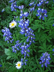
I wasn't satisfied with my intern experience being my only exposure to Mount Rainier, so I went back for a camping trip to get lots of hiking in. Didn't do anything terribly difficult, and I didn't even try to fully conquer the trail up to Panorama Point (did a good chunk of it up to the glacier vista, though) -- I just wanted great views. I unintentionally picked "Free Weekend," which saved $25 or so, but it also resulted in large crowds at Paradise on Saturday. But things were still gorgeous -- huge trees at Grove of the Patriarchs, turquoise colored lakes all over the place, mountain range views, wildflowers everywhere... This place was ridiculously gorgeous. My words don't do it justice. My pictures do a slightly better job.

Hike 7: Colchuck Lake - 9 miles, 2200 ft gain
Trailhead directions and other information on WTA.
It was October, temperatures were dropping, and people were happy to settle into the intermediate lazy season -- when it gets too cold and rainy to do summer activities, and there isn't any snow to do winter activities. But not me! I found a weekend where it wasn't supposed to rain, and I decided that I was going to see some leaves of different colors. And in order to get this, we were heading east of the Cascades, the longest drive to a day hike we'd done to date. Jenny was the only one nuts enough to agree to be dragged along (this trip involved leaving quite early in the morning because it was a long drive, and it was starting to get dark pretty early).
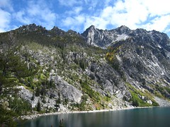
The colors did not disappoint, and we started getting really excited once we crossed Stevens Pass and started seeing bright reds and oranges. We pulled over to take some pictures, and that's when we started noticing the temperatures. 30-something? Ooh, it was cold. When we got to the trailhead, I think the car was saying 31 degrees, and despite a forecast for 0% preciptation, there were bits of white dust falling from the sky. Once we started hiking, we warmed up, and there were lots of pretty colors along the way to keep us going. 9 miles definitely made for a long hike, though, especially on the way back. The lake was beautiful (though I hoped for more golden larch trees) - really big with that clear turquoise water. Colchuck Lake is the gateway to the Enchantments, probably the best backpacking trip in Washington, and we could see Aasgard Pass, the nutso climb you have to do in order to get into the Enchantments from this side. Maybe next time. :)
Hopefully next summer will be full of more beautiful hikes! For now, I am looking forward to hitting the ski slopes...
About This Blog
This is yet another incarnation of my personal blog. Here's where you can read about what I do when I'm not at work: hiking, seeing plays and other shows, eating, traveling, etc.
Popular Posts
-
When people learn of hot yoga, usually they hear of Bikram Yoga , a system of yoga developed by Bikram Choudhury. He’s a controversial fig...
-
The Ruins of Us by Keija Parssinen Genre : Contemporary fiction Rating : ****1/2 (out of 5) Recommended for : people interested i...
-
While it seems like most other people in the world are currently scrambling frantically to start their restrictive diets and health resoluti...
-
The Gutenberg Rubric by Nathan Everett Genre : Historical thriller Rating : ***1/2 (out of 5) Recommended for : Dan Brown/thrille...
-
Puss in Boots USA, 2011 Watched : in theater, Bella Botega Rating : **** (out of 5) This is one I would have watched on DVD years...
-
I still owe trip reports from the Canada trip, but this weekend was so exciting that it seems like I need to get to this one first. ...
-
Lupine and other wildflowers I had a busy summer and fall in 2017 and have done a poor job maintaining this blog. I’m hoping that duri...
-
Havana Real by Yoani Sánchez Genre : Non-fiction, memoir Rating : ***1/2 (out of 5) Recommended for : People who enjoy blog posts, ...
-
Running the Rift by Naomi Benaron Genre : Contemporary Fiction Rating : **** (out of 5) Recommended for : runners, people who rea...
-
Distance : 10 miles Elevation gain : 3500 feet Trailhead directions and more information on WTA . I did this hike back in late Sep...
Copyright 2009 | adventures of a tired coder
Natural health theme designed by the Jinsona Design and XML coded by CahayaBiru.com
Natural health theme designed by the Jinsona Design and XML coded by CahayaBiru.com

0 comments